UK satellites play an important role in environmental monitoring, tracking greenhouse gases, forest coverage, water movement and weather patterns from orbit. Scientists and public bodies use measurements from Earth observation satellites to provide tools that can lead to emissions cuts and better forecasts. The data also help them understand climate change and prepare for climate change risks which may pose hazards in the future.
Why Climate Monitoring Uses UK Satellites
Climate science and environmental monitoring rely on dependable, long-term data about the air, land and sea. The Global Climate Observing System (GCOS) lists 55 Essential Climate Variables (ECVs), and satellites can monitor about 60% of them. Their global coverage also provides consistent records for places that are difficult to reach from the ground.
The European Space Agency (ESA)’s Climate Change Initiative (CCI) draws on decades of earlier observations. It produces climate records for 21 variables, including greenhouse gases, clouds, soil moisture, glaciers, sea ice and sea level. Each dataset includes an uncertainty estimate, which lets scientists test models and compare results. Scientists use these records in climate research, environmental monitoring, risk assessments, adaptation plans and international climate agreements.
What UK Satellites Actually Do for Climate Monitoring
Earth observation satellites use different instruments to measure parts of the climate system. Some track gases in the atmosphere; others monitor land cover, plants, ice, or water movement. Radar can collect data even when clouds obscure the surface.
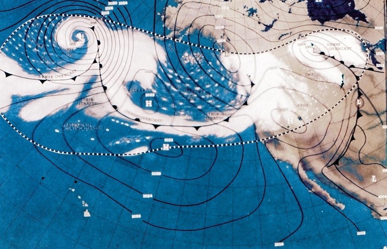
Weather services use satellite images to improve forecasts. The Met Office processes data on winds, humidity, aerosols, snow, plants and sea-surface temperatures, then feeds selected readings into its Unified Model. This helps meteorologists track evolving weather systems and other hazards.
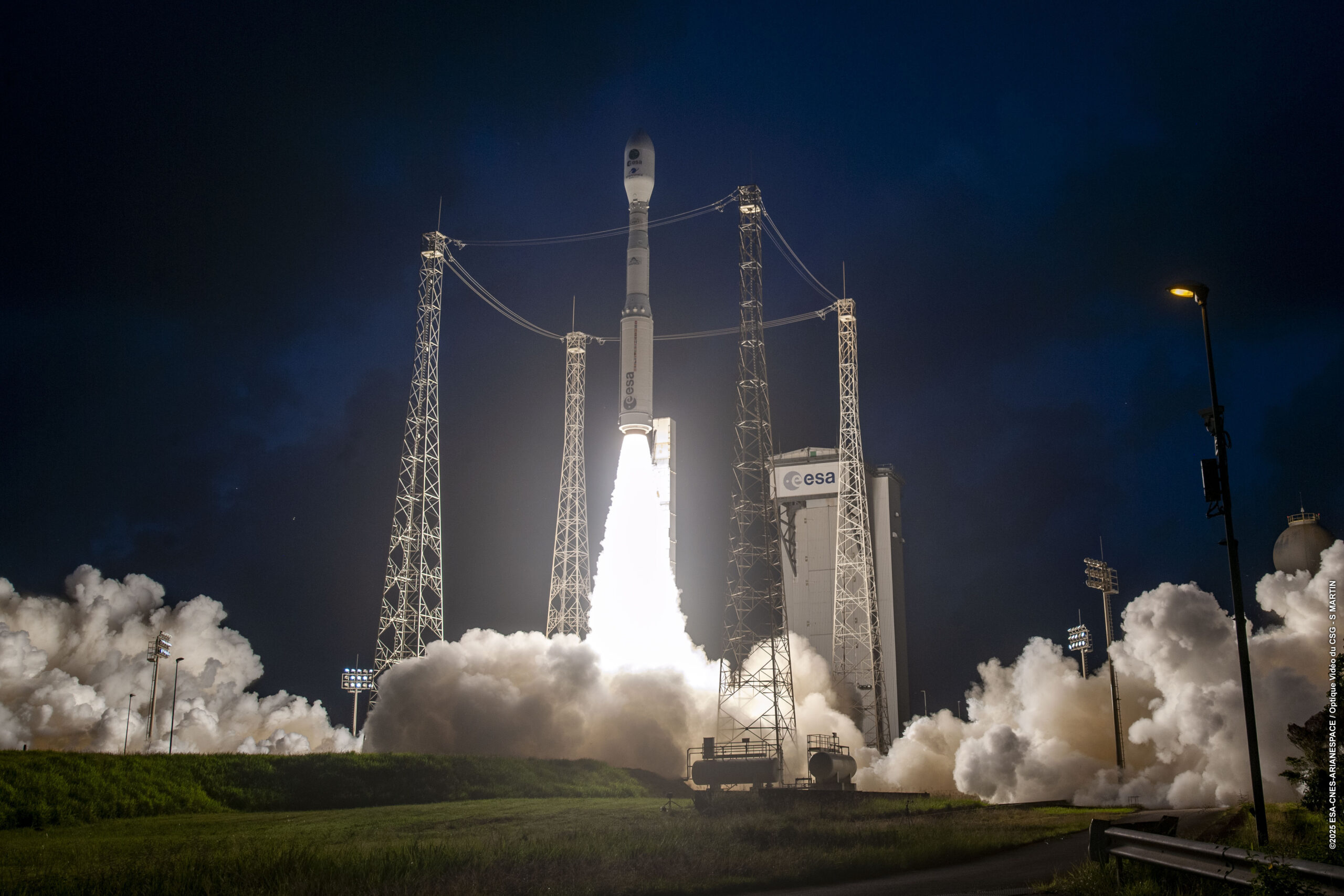
ESA’s Aeolus satellite used Light Detection and Ranging (LiDAR) to measure global wind profiles in near real time. Its data improved daily forecasts and helped scientists study the changing atmosphere. The mission ended in July 2023, but its results now guide plans for a more capable follow-on mission called Aeolus-2, although a launch timeline has yet to be confirmed.
Major UK Climate Missions
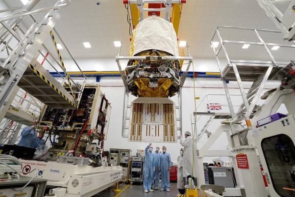
UK satellites enable several major climate missions, including ESA’s Biomass satellite which Airbus built at its Defence and Space facility in Stevenage, with major input from British universities including Sheffield and Aberystwyth. Its P-band radar maps forests in three dimensions and can see through clouds and tree canopies. This allows it to assess stored carbon more accurately than methods which examine only the canopy, providing valuable data for climate change research. The mission enables environmental monitoring of tropical, temperate and boreal forests.
The Hydrological Global Navigation Satellite System (HydroGNSS) programme focuses on the water cycle. The UK-led mission uses reflected navigation signals to measure soil moisture, flooding, frozen ground area and plant coverage. Its two satellites can also observe through thick clouds and dense forest. The data can be used in flood prediction and ecosystem monitoring, which is especially useful in agriculture.
Britain’s Traceable Radiometry Underpinning Terrestrial- and Helio-Studies (TRUTHS) satellite serves a different purpose. This mission will produce highly accurate measurements of incoming and outgoing radiation to assess the extent and rate of global warming due to greenhouse gas emissions. Cross-calibration with other satellites will reduce uncertainty and help scientists detect these changes to the climate sooner.
How Earth Observation Satellites Produce Data Leading to Action
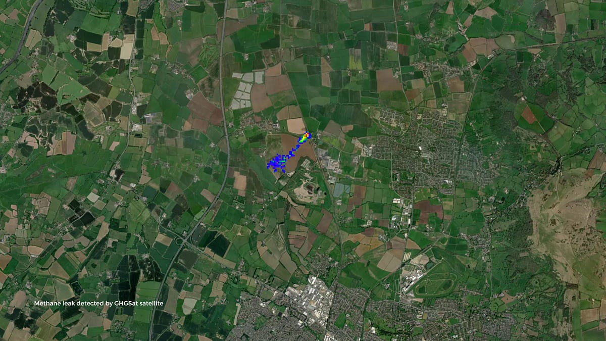
Organisations use satellite measurements to make decisions. In March 2023, researchers using Greenhouse Gas Satellite (GHGSat) data discovered excessive methane emissions from a faulty gas pipeline in Cheltenham. Follow-up checks measured releases of about 200 to 1,400 kg per hour. Researchers alerted Wales & West Utilities, and the company repaired the fault by June 13. After the repair, satellites detected no further emissions. The methane released over 11 weeks equalled a year’s electricity use for more than 7,500 average homes. In this case, satellite detection led directly to a repair and a cut in emissions.
The UK methane monitoring programme also holds big companies to account, monitoring sites linked to agriculture, coal mining, oil and gas, landfills and wastewater treatment. For sites that are difficult to inspect, space-based environmental monitoring can provide independent evidence across a large geographical area.
Uses Across Industries
Officials and researchers in forestry and agriculture use data from Earth observation satellites to measure biomass and plan land use. Satellite data can be combined with drones and human inspection to identify tree species. More accurate biomass estimates help with woodland monitoring and carbon accounting.
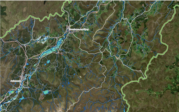
Water companies use radar and reflected navigation signals to track extreme events such as floods and droughts. In Scotland, Sentinel-1 radar images have been used for emergency flood mapping. Weather services use Earth observation satellite data for short-term warnings, while specialist missions can provide more detail about water scarcity, helping to plan irrigation methods.
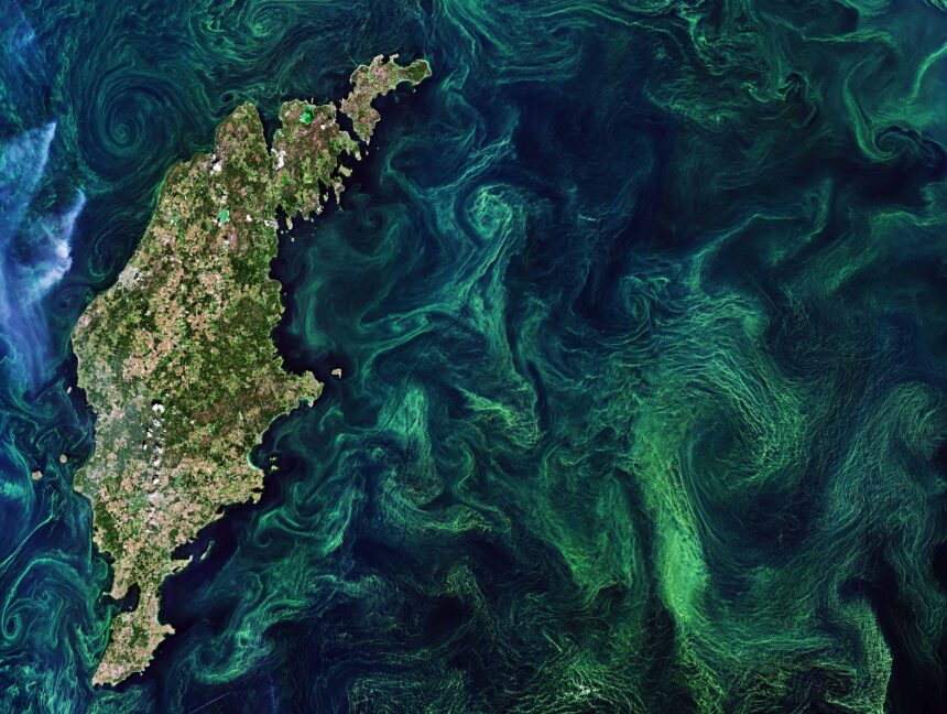
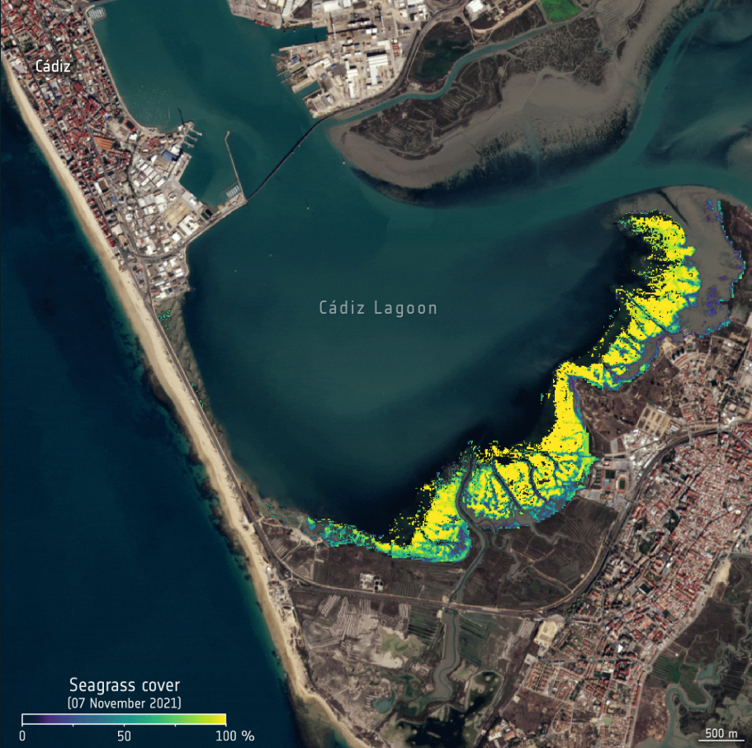
Marine scientists use ocean colour data to study photosynthesis and carbon storage by phytoplankton. Other projects map seagrass meadows and estimate how much carbon they hold. Aviation researchers are using satellite and ground data to improve sustainable fuel supply chains and biomass sourcing.
Who Develops and Operates UK Satellites?
The UK Space Agency (UKSA) funds missions and services on a national level, while ESA provides shared programmes and wider infrastructure, including in launch and space operations. Universities such as Leeds, University College London (UCL), Northumbria and Plymouth develop the instruments and models used by UK satellites, then industry partners build and operate the hardware.
British industry plays a major role in designing and building UK satellites and their instruments. Airbus has built hardware for Copernicus, the Meteorological Operational satellite (MetOp), Aeolus and Biomass. Surrey Satellite Technology Ltd (SSTL) designed and built the HydroGNSS satellites.
UKSA is also funding early-stage environmental monitoring and climate service projects. Six projects received a combined £380,000 in October 2025 to develop commercial tools covering seagrass and woodland surveys as well as sustainable aviation fuel sourcing.
Limits and Risks of Monitoring Earth from Space
Earth observation satellite measurements require careful validation and interpretation. Different instruments may measure the same variable in different ways or at different resolution, while clouds and surface conditions can also affect the results. The cross-checking planned for use in TRUTHS is designed to improve consistency across the observation system.
Space infrastructure is also vulnerable to climate risks. Floods, wildfires, extreme heat and storms can damage ground stations or disrupt launches. Heavy rain can weaken some communication signals. Rising carbon dioxide levels also reduce the density of the upper atmosphere, lowering the drag on satellites and debris in low Earth orbit. With less drag, objects remain in orbit for longer and the risk of collisions rises.
UKSA’s Climate Change Adaptation Report rates current concern as generally low. It expects greater risks from floods and severe weather, as well as failures in energy, communications and supply infrastructure. The review says future projects must have policies in place to protect satellites and the ground systems they rely on.
Upcoming Climate Missions and Data Services
Upcoming UK satellites will measure forests, water, radiation, temperature, gases and land conditions in ever greater detail. MetOp Second Generation (MetOp-SG) will continue taking long-term weather and climate records. Planned missions such as Land Surface Temperature Monitoring (LSTM), Copernicus Polar Ice and Snow Topography Altimeter (CRISTAL) and Radar Observing System for Europe in L-band (ROSE-L) will enhance monitoring related to food and water security.
The data also have to become easier to use. Effecting change using these services depends on clear research and analysis methods and more intuitive, better-presented information. Tools for policymakers and businesses must lend themselves to producing strategy decisions from the raw satellite observations.
Britain already has experience in remote sensing and climate risk modelling. Now, more than ever, that work depends on accurate, reliable instrumentation, shared data and close cooperation. Earth observation satellites do not cut emissions or protect ecosystems on their own; they reveal where climate action is needed and whether it has worked.
Could more accurate satellite monitoring change how governments measure progress towards climate targets? Let us know in the comments section below.