
Why Ukraine’s Airspace Is Still Closed in 2026
No commercial flight has left a Ukrainian runway since the morning of February 24, 2022. The U.S. State Department rates the country Level 4, Do Not Travel, in an advisory issued August 28, 2026. The FAA bars U.S. operators from Ukrainian airspace by NOTAM. On the European side, EASA revised its conflict zone bulletin on July 24, 2026. It runs until January 31, 2027. Four years and eight months in, nobody has published a date for a change.
The reasons are specific. So is the list of things that would have to change before an airline files a flight plan to Kyiv.

What closed the sky on February 24, 2022?
Ukraine’s air navigation service issued a NOTAM in the first hours of the invasion. It closed the airspace to all civil traffic. EASA followed the same day with a conflict zone bulletin. The bulletin warned of intentional targeting and of misidentification of civil aircraft. Three days later, Russian shelling at Hostomel airfield destroyed the An-225 Mriya in its hangar.
Aviation had a precedent to draw on. In July 2014 a surface-to-air missile brought down Malaysia Airlines MH17 at 33,000 feet over eastern Ukraine. That airspace was still open to overflights. Regulators have not been willing to repeat the calculation.
Which document keeps it closed?
The legal closure is the Ukrainian NOTAM and the country’s AIP. The Aeronautical Information Service of Ukraine publishes both. Operators receive them through their briefing providers. EASA’s bulletin is CZIB-2022-01R14. It covers all altitudes in six regions. Those are the Lviv, Kyiv, Dnipro, Simferopol and Odesa FIRs, plus the Kyiv UIR. It is a recommendation, and national authorities in Europe follow it. The number has not changed since 2022. The suffix has moved from R1 to R14. That is a count of how many times the agency looked and found no reason to lift it. The FAA’s NOTAM binds U.S. carriers and pilots. Martial law in Ukraine is a fourth instrument on its own clock. Parliament extends it in 90-day steps, and the current term runs to October 31, 2026. Ending martial law would not open the sky.
Why not a corridor in the west?
Pilots ask this most. Lviv sits about 70 kilometers from the Polish border. The problem is what crosses that sky.
Russian attacks now mix ballistic missiles, cruise missiles and long-range drones in the same wave. In late August the government in Kyiv said jet-powered drones had pushed the capital past ten alerts a day. They are harder to intercept than the propeller Shahed type. A corridor needs more than distance from the front. It needs a guarantee that nothing launched at a city 500 kilometers east will cross it. It also needs a guarantee that no interceptor will be fired through it.
Then there is navigation. GNSS jamming and spoofing along the eastern edge of Europe grew bad enough that EASA and Eurocontrol published a joint action plan in February 2026. An aircraft that cannot trust its position is a poor candidate for a narrow corridor.
The binding constraint sits with insurers and lessors. No underwriter prices war risk for Ukrainian airspace at a rate an airline could carry. Most leases also bar operation into listed territories. A lessor’s consent is a separate permission from a regulator’s.
How does Ukraine track what is in the air?
Military radar and observer posts feed the Air Force. The Air Force issues threat data by region. Regional administrations trigger sirens and push the alert to apps and Telegram channels. The whole country runs on this feed, from Ukrzaliznytsia dispatchers to the Kyiv metro. During an alert the metro keeps trains underground and off the Dnipro bridges.
Since September 6, 2026, Kyiv splits alerts into two levels. Yellow means drones, and surface metro sections stop running. Red means missiles or a massed attack, and shopping malls close as well. Flight trackers show Ukraine as a blank. Civilians read the public alerts in Ukraine map instead, which plots Shahed tracks, missile headings and estimated arrival times by region. For anyone used to watching ADS-B, it is a strange inversion. The only objects on the screen are the ones you do not want to see.
What is happening at Kyiv’s airports?
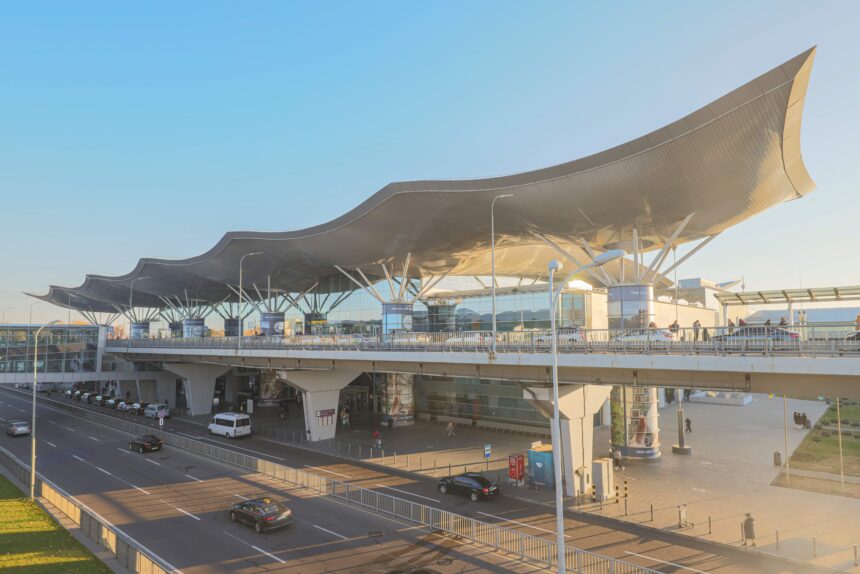
Boryspil handled more than 15 million passengers in 2019 and was Ukraine’s main hub. Zhuliany, inside the city limits, served the low-cost market. Both carry the status “suspended” today. Staff maintain the terminals. A modernization program with South Korea’s KOICA agency is under way so the airports can restart fast. The current state of Kyiv’s airports, with the overland routes that replaced them, sits on a page the local city guide Visit Kyiv keeps updated.
Hostomel, where the Mriya burned, was never a passenger airport.
What would a reopening look like?
A sequence, and each step can be checked. The Ukrainian government formed a working group on March 16, 2026 to plan a phased restart. Lviv is the likely first airport. Talks with IATA and ICAO are continuing. Since then, no commercial flight has operated.
For a corridor to open, the Ukrainian NOTAM would have to be amended first. EASA would then revise or withdraw CZIB-2022-01R14, and the FAA its own notice. Underwriters would price war risk for the defined corridor. The airports and the air navigation provider would have to prove readiness. That now includes the digital and security systems insurers ask for. Lessors would have to consent, aircraft by aircraft. Nobody has put a date on any of those steps. The one date that exists is the end of the current EASA bulletin, January 31, 2027. Unless a revision appears before then, that is the earliest point at which the European advice could change.
How do people get to Kyiv in the meantime?
They fly to Poland. From Rzeszów or Kraków, the Intercity from Przemyśl reaches Kyiv in about ten hours. The direct sleeper from Warsaw takes sixteen and a half hours. It sells out fast once tickets appear 20 days ahead. Kyiv’s central railway station has taken over the role Boryspil used to play, air raid stops included. If you plan the trip, the State Department advice still applies. Level 4, and the embassy cannot help you in person.