By using this site, you agree to the Privacy Policy and Terms of Use.
Accept
Travel Radar - Aviation NewsTravel Radar - Aviation News
  • Breaking News
  • Aviation
    • Aircraft
    • Airlines
    • Airshow & Events
    • Careers
    • Manufacturing
  • Travel
    • Airports
    • Points & Loyalty
    • Technology
    • Trip Reviews
  • Newsletters
  • Aircraft for Sale
Reading: SID, STAR – What do Pilots use while flying to Depart and Arrive into Airports?
Share
Sign In
Notification Show More
Font ResizerAa
Font ResizerAa
Travel Radar - Aviation NewsTravel Radar - Aviation News
  • Breaking News
  • Aviation
  • Travel
  • Newsletters
  • Aircraft for Sale
  • Breaking News
  • Aviation
    • Aircraft
    • Airlines
    • Airshow & Events
    • Careers
    • Manufacturing
  • Travel
    • Airports
    • Points & Loyalty
    • Technology
    • Trip Reviews
  • Newsletters
  • Aircraft for Sale
Signin Sign In
Follow US
Copyright © Travel Radar Media Ltd. 2025 | All Rights Reserved
Travel Radar - Aviation News > News > SID, STAR – What do Pilots use while flying to Depart and Arrive into Airports?

SID, STAR – What do Pilots use while flying to Depart and Arrive into Airports?

Travel Radar Staff
Last updated: 3 April 2020 14:32
By Travel Radar Staff
4 Min Read
Share
A pilot using an iPad with charts ©Sporty's
SHARE

Have you ever wondered as a passenger or as an aviation enthusiast on what it takes for pilots to navigate the aircraft to and from busy airports? Apart from checklists and manuals entirely related to the aircraft, pilots also carry charts allowing aircraft to safely take-off and arrive at an airport. These procedures called Standard Instrument Departure Route (SID) and Standard Arrival Route (STAR) are illustrated in charts called instrument procedures.

Summary
What are SIDs and STARs?Interested to know what SID and STAR charts contain? See below!Who build these charts?

What are SIDs and STARs?

SID is a predefined route depicted on a chart by which an aircraft should proceed from take-off to en-route phase. It includes vital information such as waypoints to follow, speed to maintain, and frequencies to contact ATC. The chart also lays down procedures about the route to follow in case of an emergency.

STAR is a predefined route by which an aircraft is guided from en-route to arrival phase. It also includes various information similar to SID.

Digital devices with aeronautical charts ©Flickr

SID and STAR are produced with an objective for the safe and expedited passage of aircraft at busy airports with multiple runways or even one runway. Sometimes each runway has a different SID and STAR. Neighbouring airports within close range of a busy airport often create a traffic hazard. SID and STAR help in mitigating that risk of collision within a certain radius of an airport before the aircraft path enters an en-route phase. Flight crew shall comply with these routes unless explicitly cancelled or amended by air traffic controllers.

Typically SIDs and STARs have speed restrictions, checkpoints to pass-through, and flight levels to maintain. Interestingly these charts help aircrew and ATC to communicate in standard phraseology which eliminates long and cluttered transmission. Generally, most airports have multiple SID and STAR to cater to different directions. Pilots before entering the cockpit while filing the flight plan mark down the SID and the STAR that is convenient for the route. This helps ATC in planning to clear aircraft accordingly.

Interested to know what SID and STAR charts contain? See below!

New York’s JFK Airport STAR Chart explained. For illustration purpose only!

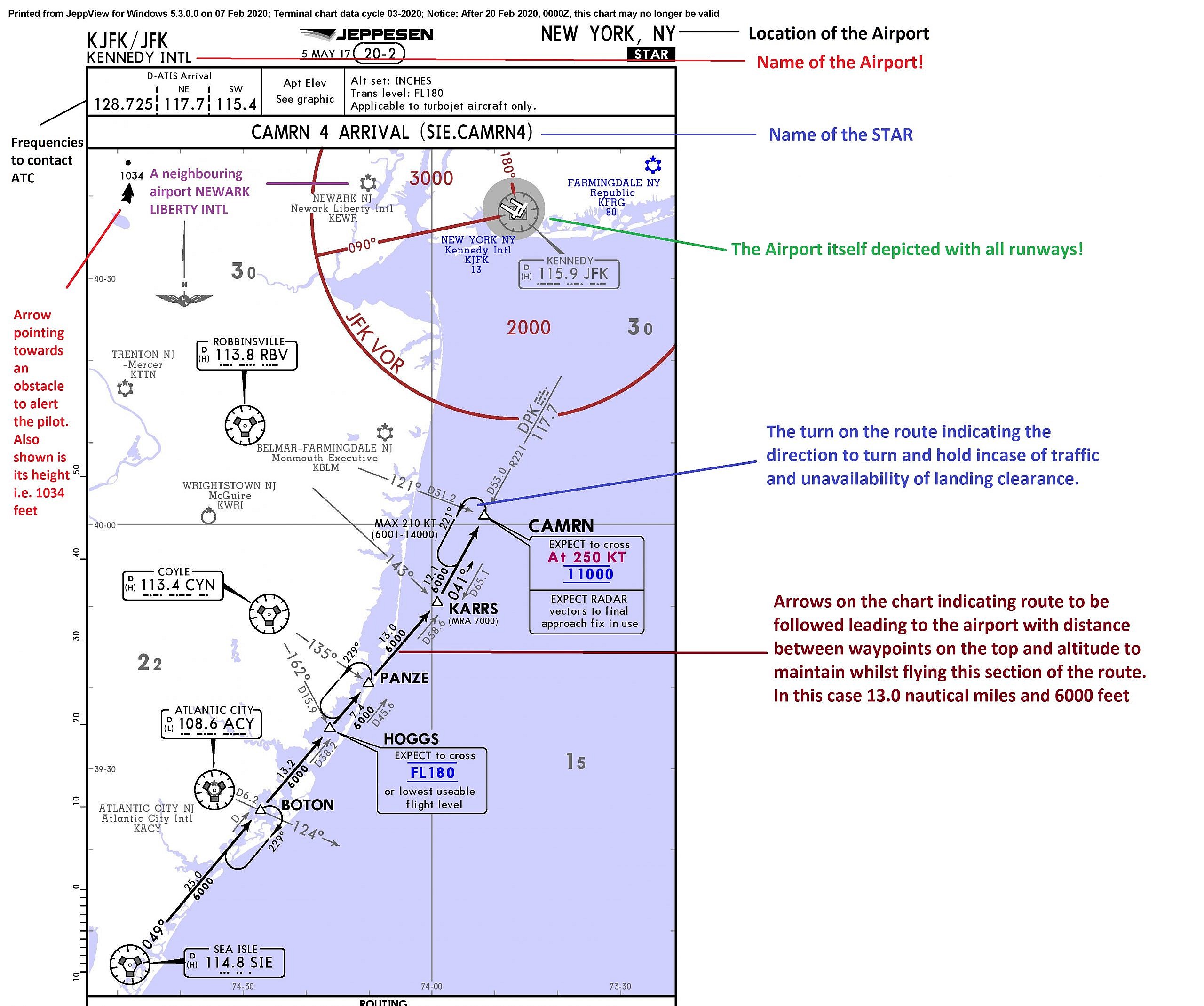
The image above clearly explains important details pilots usually look for in a SID or STAR chart. In modern aircraft, pilots need not hand fly to navigate through these turns or maintain altitude. The onboard computers contain all SIDs and STARs of all airports allowing pilots to just monitor these charts as the aircraft eases through these routes. Not just that, the aircraft also maintains other restrictions like altitude and speed as provided in the chart.

Who build these charts?

Jeppesen, a Boeing owned company manually designs these charts inline with Aeronautical Information Publication (AIP – an ICAO regulated published material usually designed by state authority) while taking into consideration the airport layout, its surroundings, and any constraints. Jeppesen charts popularly known as Jepps charts include SID, STAR, en-route and various other instrument approach procedures.

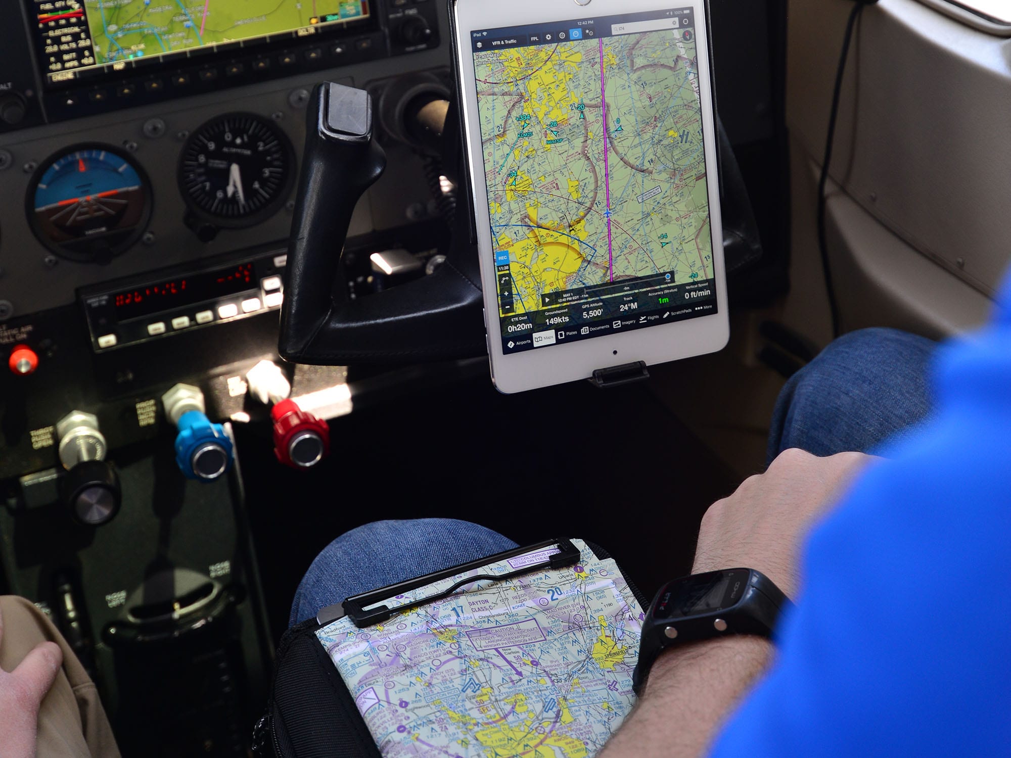
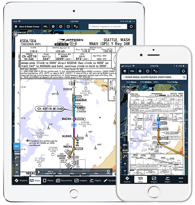
Most airlines around the globe have started to use Electronic Flight Bag (EFB) which includes these charts on a digital tablet. This certainly makes the job of a pilot easier!

You Might Also Like

IndiGo Airlines Fined Over December Disruptions
Lufthansa Saved
England and Scotland will require overseas arrivals to present negative COVID-19 tests prior to travel
Cebu Pacific strengthens its partnership with Lufthansa Technik for integrated consumables and expendables supply
Lufthansa to Retrofit Continental Fleet
Share This Article
Facebook Twitter Email Copy Link
What’s your thoughts?
Love0
Sad0
Happy0
Angry0
ByTravel Radar Staff
Follow:
Articles from guest contributors wishing to remain anonymous are credited to this account. Want to contribute to Travel Radar either in-name, or anonymously? Get in touch: [email protected]
Previous Article How Luftwaffe plans to revive its ‘aging’ Tornado fleet?
Next Article © USAF Another Problem for Boeing; Now it’s the KC-46 Tanker
1 Comment
  • MixMor says:
    26 November 2020 at 14:31

    thx much for the invitation :).
    PS: How are you? I am from France 🙂 very good forum 🙂 mixx

    Reply

Leave a Reply Cancel reply

Your email address will not be published. Required fields are marked *


Stay Connected

FacebookLike
TwitterFollow
InstagramFollow
YoutubeSubscribe

Trending News

Centre right a large white domed building with ornate trim designs and archways sits of the edge of a canal, which occupies the centre left. The picture is taken from a bridge over the canal. In the foreground, flowers and foliage along the edge of the bridge can be seen. In the background another building can be seen from a distance against a blue sky with a few small clouds.
Norse Atlantic Expands Capacity from UK to Thailand
Airlines Aviation Route Development
Two people sit in the cockpit of an aircraft. The picture is taken from behind them, focusing on the controls, which are of various bright colours against a dark background. The backs of the two people's heads are stylistically blurred. The front windows can be seen. the the view of outside is just white-ish grey, as if surrounded by clouds.
Passengers Restrain Pilot due to Mid-Flight Medical Emergency
Aircraft Aviation Incidents & Accidents
Image shows a small blue aircraft (Piper PA-28-151 Cherokee Warrior N405DS) grounded at Delaware Airpark during the day.
Fatal small plane crash in Washington
Aircraft Aviation Incidents & Accidents
Tecnam P2012 traveller aircraft flying through the clouds
Air Oceania resumes flights after fuel shortage halts operations
Aircraft Airlines Travel
Avianca Boeing 787-8 side view in flight
Avianca to relocate Fort Lauderdale operations to Terminal 4
Airlines Airports Manufacturing

Travel Radar is the leading digital hub for all things aviation and air-travel. Discover our latest aviation news, aviation data, insight and analysis.


Discover

  • Latest News
  • Subscribe
  • Weekly Digest
  • Contact Us
  • Privacy Policy
  • About Us
  • Advertising
  • Media Coverage
  • Press & Events
  • Join Our Team
  • Our Brands

Signup to our Newsletter!

And get the latest aviation news via our weekly news digest!

© Travel Radar Media Ltd. 2015-2026 | ISSN #2635-0696 | Trademark #UK00003579704
adbanner
Welcome to the TR Community!

Sign in to your account

Not a member? Sign Up